Hike & Run Pisgah National Forest
There is so much to see and do in Pisgah. Pisgah is nirvana for hikers, bikers, and waterfall hunters. Avid local hikers will tell you the trails change drastically with the different seasons and each season offers special treats. In the winter, what seemed like a walk in a dense forest in the summer, is like opening a present to see everything that was hidden by the leaves. Nearly every trail includes some kind of water from a simple stream to a raging waterfall. The main entrance to Pisgah National Forest is where Highways 64, 280, and 276 meet.
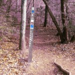
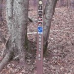
NOVICE Hikers: If you’re unfamiliar with trail markers here is a quick definition. Green circles designate easy trails – these trails tend to be relatively flat and free of obstructions. Blue squares designate moderate trails – these trails often include some steep grades, paths riddled with tree roots, and stream crossings. Black diamonds designate difficult trails – these trails are a step up from the blue trails and are often long. Tip #1: When hiking the blue and black trails, please remember to bring water and snacks. All food should be double bagged (to keep the animals from smelling it). Tip #2: Pay attention to daylight hours. You don’t want to be caught on a trail after sunset without a flashlight.
Looking Glass Falls, Easy
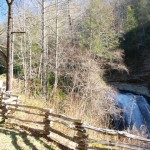
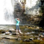
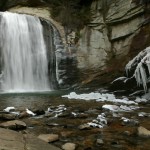
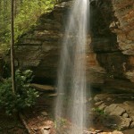
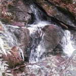
Looking Glass Falls is likely the most photographed waterfall in western North Carolina, if not the east coast. The wide vertical drop is visible from the road making it must see for anyone visiting the area. There are several good viewing areas; one from the road, one at the middle of the stairs, and numerous at the base of the falls. When traveling with kids, try to get them out on the rocks in front of the fall so they can marvel at the wind the rushing water creates. Directions: 9 miles into Pisgah National Forest on 276. The pull off is well marked and on the river side of the road. Trail Characteristics: paved sidewalk and stairs. Fun river rock climbing at the bottom of the stairs.
Davidson River Exercise Trail, Easy, 1.5 mile loop
The exercise trail (#344) is a flat loop that runs between the Davidson River and the campground. Just after the English Chapel take a right across the bridge and pick up the trail on the other side of 276. The trail ends just opposite the entrance to the campground. Directions: Turn off 276 approximately one mile into the park at the Davidson River Campground entrance. Parking for people who are not camping is to left before the bridge. Cross the bridge and find the trail head to the right just after the bridge. Trail Characteristics: Flat, mostly wide, some rocks and roots.
North Slope, Moderate, 3.7 mile loop
See if you can find the tree stump shaped like a heart along the North Slope Trail (#359). The trail is a nice size path with a steady incline and some interesting stream crossings. It is a lovely walk in the woods. The trail ends at the camp amphitheater – walk through theater to the other side and you will be dropped off onto the camp road. Take a right and follow the road out of the campground then left back to parking. Directions: Follow the parking directions for Davidson River Exercise Trail and instead of crossing the bridge at the English Chapel stay straight on the trail along the river. You’ll come to two trail markers that can be confusing. The one to the left cuts a large part of the trail off and really just goes around the campground. Continue on to the right for the ‘real’ trail. After a long incline you’ll see a trail head for the Art Loeb Trail – go to the left instead to continue on North Slope.
Moore Cove, Easy, 1.4 miles round trip
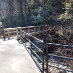
Moore Cove Trail (#318) was recently reconstructed and now includes an overlook (of sorts) which is nice for folks not interested in climbing over the rocks to get the best view. Locals – never fear – you can still get behind the falls. The biggest casualty of the reconstruction is the felling of a few trees to the right of the falls. This is a relatively mild walk with some inclines in places, no different really than walking several flights of stairs. Directions: Parking for Moore Cove is to the right off 276 (if you are heading north) past the Looking Glass overlook after the road takes a sharp curve to the left. The parking area is larger than the numerous little pull-offs you find along 276 and can easily accommodate 10 cars. (hint – that’s how you know you’re in the right spot) Trail Characteristics: Wide trail, wood bridges, mild inclines.
Sycamore Cove Trail, Moderate, 3.2 mile loop
This is a beautiful hike no matter the season. The trail (#143) up to the ridge may be tough for some – make sure you bring water. The trail crosses streams and runs along water for a while. May be too long for small children but a fantastic bit of exercise for kids from 8 to 60. This is also a mountain biking trail. Directions: park in the second pull off from the entrance to Pisgah National Forest. The trail head is across the street near the two utility boxes. (It’s not really visible from the road) The trail drops you off onto the road a little north of your car so you will need to cross the road and walk back along the road (please be careful). Trail Characteristics: Partly narrow path, roots, rocks, long steep inclines, stream crossings. ADDITION: Add a side trail – Along Sycamore Cove there is a side trail marked as Grassy Road (#364, 1 mile), it is a very easy wide patch and ties back into Sycamore Cove just pay attention to the trail makers to the left.
Avery Creek Trail, Moderate, 3.2 one way
3.2 mi Moderate hike but fast and bumpy single track Mountain biking not for the beginner. – The first, two-mile section of the trail treats the visitor to pretty cascades and pools along Avery Creek. Approximately 0.5 miles upstream, Buckhorn Gap Trail (#103) enters from the left, overlaps Avery Creek Trail for a short distance, and then departs to the right. Avery Creek Trail continues to follow the creek for approximately another 1½ miles before leaving it and climbing moderately for the rest of its length. You will then find yourself in a mature hardwood forest of yellow poplar, red maple, and hickory trees, and will pass thru a two-age cut, one example of a forest management practice. The trail ends at Club Gap, where it intersects with the Buckwheat Knob (#122), Black Mountain (#127), and Club Gap (#343) trails.


