DuPont Forest Waterfalls
DuPont State Forest is a wonderfully kept forest with well defined trails and convenient parking. The waterfalls in DuPont are breathtaking and easily accessible.
Triple Falls
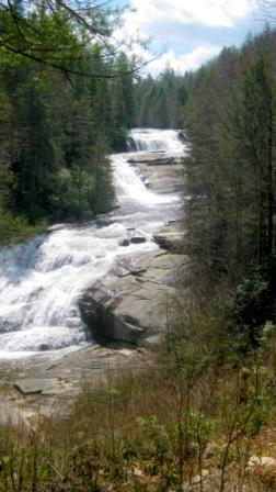 The third of the Little River Falls, Triple consists of three distinct cascades, totalling about 120′ in vertical drop. Featured in the movies The Hunger Games and Last of the Mohicans, Triple Falls is about a seven minute walk from the Hooker Falls parking
Directions: To get to Triple Falls from Brevard leave downtown traveling south on 276 (Main Street). Stay on 276 for a little over 10 miles and turn left onto Cascade Lake Road after another 2.5 miles turn right onto Staton Road (if you end up on a gravel road you missed the turn). Once on Staton Road you will travel a little over 2 miles – when you cross the bridge turn into the parking area on the left just past the bridge. At the end of the parking area you will see stairs that lead up to the road. Take the stairs cross the road and the bridge and go down the stairs on the other side of the river. Once at the base of the stairs the trail leads to the right.
High Falls
The second and tallest of the Little River falls, High Falls slides 150′ down an inclined plane of granite. The falls can be viewed from a picnic shelter, built on the site of the old Buck Forest Hunt Club lodge, or from a slippery trail to the bottom of the falls.
Directions-From the parking area, take Buck Forest Road about 1/3 mile, then turn left on Triple Falls Trail and an immediate right on High Falls Trail. Continue straight (avoiding several right forks) to find the High Falls Shelter and views of the falls.
From Triple Falls, continue up the same trail until the intersection with High Falls Trail. (Triple Falls to the right goes to Buck Forest Road.) Turn left and walk about 2000′ parallel to the Little River. Turn right at the next intersection (still High Falls Trail), and continue up a moderately steep slope (about 900′) to views of High Falls. There is a trail to the bottom of the falls further up on the left (warning: slippery rocks!). Also, steps to the right take you to the High Falls shelter, with excellent views.
Hooker Falls
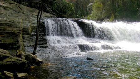
The fourth falls on the Little River, Hooker Falls drops about 11′ into Cascade Lake. Part of the original DuPont State Forest, Hooker Falls has become a popular swimming hole. Hooker Falls is the most well-known waterfall in the original DuPont State Forest, and it is easily accessible year round. The falls is at the site of a former grist mill, where Little River drops off a 13-foot high natural ledge before flowing into Cascade Lake.
Walk around the gate in the parking lot and along the dirt road, bearing left at the fork and continuing parallel to the river. In a few minutes you will approach the top of Hooker Falls. Continue straight on the path to good viewing location at the pool below.
Bridal Veil falls
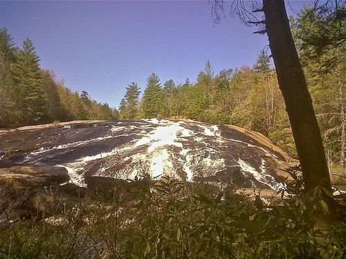
Bridal Veil Falls is truly a movie waterfall and famous for Last of the Mohicans and Hunger Games. The first falls of the Little River, Bridal Veil is probably the most unique. First, it drops off an overhanging ledge then the water sheets down a long, shallow inclined plane of granite before tumbling into the pool below. The Agfa Corporation owns the land north of Bridal Veil Falls, including the traditional access route to the Falls. See below for two newly-opened routes as well as a longer scenic route to Bridal Veil Falls through the State Forest.
Directions-
Bridal Veil Falls via Conservation Road
From the Fawn Lake Access Area, turn right 0.10 miles and take the first left on Conservation Road for 1.70 miles past the airstrip and turn left on Bridal Veil Falls Road 0.53 miles to the base of the Bridal Veil Falls. Total=2.33 miles.
Bridal Veil Falls via Fawn Lake
From the Fawn Lake Access Area, turn left on Fawn Lake Loop 0.78 miles and right on Airstrip Trail 0.53 miles, left on the airstrip 0.31 miles, left on new extension of Airstrip Trail 0.56 miles, left on Shelter Rock Trail (Formally Barn Trail) 0.25 miles and right on Corn Mill Shoals Trail 0.42 miles to the base of the Bridal Veil Falls. There is a nice view of the AGFA plant and Pisgah Mountain from the north end of the airstrip. Total=2.85 miles.
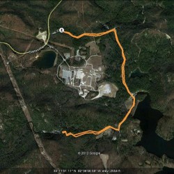 Bridal Veil Falls from Buck Forest Parking
Park at Buck Forest lot / High Falls access off of Staton Rd. Hike Buck Forest and cross over a covered bridge that is at the top of High Falls. Take a right on Conservation Rd and hike to a right turn on Bridal Veil Falls Rd. At the end of the road, the trail turns into a nice single track leading to the base of the falls. Hike to the falls is just about 2.2 miles – for a roundtrip of 4.4 miles. To download GPS coordinates from Wikiloc, CLICK HERE.
Wintergreen Falls
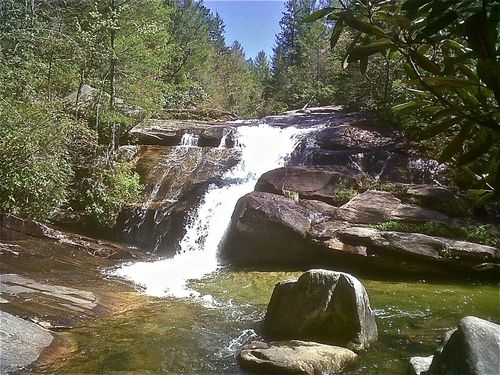
Wintergreen Falls is one of the lesser known in DuPont, yet it is very accessible and majestic! At the bottom of the Grassy Creek Gorge lies Wintergreen Falls, which is about a 20 minute walk from the Guion Farm parking area. The name “Wintergreen” was chosen due to the occurrence of the evergreen groundcover (also known as teaberry) in the Grassy Creek area.
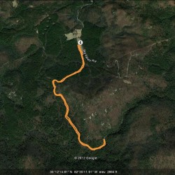 Directions: Park at the Guion Farm access lot off of Sky Valley Road in DuPont. Park near the kiosk with a very large DuPont map. Behind the kiosk is a very large field with a trail to the far right – take that trail. It is known as Tarkiln Branch Road. Follow Tarkiln for approx 1 mile and turn left onto Wintergreen Falls Trail follow to another left that continues on Wintergreen Falls Trail. Follow until you get to the falls – total distance is just about 1.5 miles – roundtrip at about 3.1. To download GPS coordinates from Wikiloc, CLICK HERE.
Grassy Creek Falls
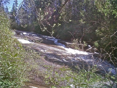
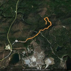 Grassy Creek Falls is a lesser known one in DuPont, yet a beautiful area and a hike that should not be ignored. Park at the Buck Forest lot / High Falls access off of Staton Road. Hike Buck Forest and cross a beautiful covered bridge at the top of High Falls. Continue on Buck Forest and then turn left on Lake Imaging. Follow a short distance to another left on Grassy Creek Falls Trail. The falls will be on the left and there a few spur trails you can take for exploration purposes! BEAUTIFUL. Hike to the falls is about 1.4 miles – roundtrip of 2.8. To download GPS coordinates from Wikiloc, CLICK HERE.


