Waterfalls of Pisgah National Forest
Pisgah has so many waterfalls that many of them are not on the typical maps that you find out there. We are working hard to get them all on to this site so keep coming back to see what we’ve added. As your driving up 276 toward the Blue Ridge Parkway, roll down your windows to hear the sound of rushing water. The park service has done a fantastic job of providing ‘pull offs’ along the road. These pull offs are not all for waterfalls, but many of them have beautiful views of the water cascading over the rocks. You may have to scramble down the embankments to get a better view.
We’ve created a fun Waterfall Day Plan for 7 of the glorious waterfalls in Pisgah National Forest. To view a pdf of this tour, CLICK HERE.
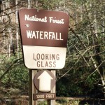
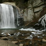
Looking Glass Falls, Easy
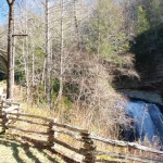
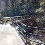
Looking Glass Falls is likely the most photographed waterfall in western North Carolina, if not the east coast. The wide vertical drop is visible from the road making it must see for anyone visiting the area. There are several good viewing areas; one from the road, one at the middle of the stairs, and numerous at the base of the falls. When traveling with kids, try to get them out on the rocks in front of the fall so they can marvel at the wind the rushing water creates. Directions: 9 miles into Pisgah National Forest on 276. The pull off is well marked and on the river side of the road. Trail Characteristics: paved sidewalk and stairs. Fun river rock climbing at the bottom of the stairs.
Moore Cove, Easy
Moore Cove Trail (#318) was recently reconstructed and now includes an overlook (of sorts) which is nice for folks not interested in climbing over the rocks to get the best view. Locals – never fear – you can still get behind the falls. The biggest casualty of the reconstruction is the felling of a few trees to the right of the falls. This is a relatively mild walk with some inclines in places, no different really than walking several flights of stairs. Directions: Parking for Moore Cove is to the right off 276 (if you are heading north) past the Looking Glass overlook after the road takes a sharp curve to the left. The parking area is larger than the numerous little pull-offs you find along 276 and can easily accommodate 10 cars. (hint – that’s how you know you’re in the right spot) Trail Characteristics: Wide trail, wood bridges, mild inclines.
Sliding Rock, Easy & Fun
Every child in Brevard has spent a summer day sliding down this rock. Winter is the best time to get pictures if you’re just interested in the view. The park service charges a $1.00 admission to this area which in our opinion is the cheapest natural roll coaster ride on the planet. In the summer the parking lot fills up fast, so get there early and slide often. Directions: Well, you really can’t miss it. Lots of good signage on 276 directs you to the entrance.
Cove Creek, Moderate
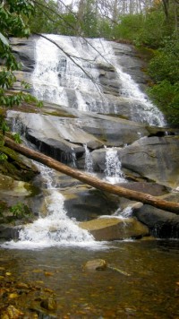 This lovely and remote waterfall is a cascading fall will a shallow pool at its base.
Directions:Driving from the main intersection to Pisgah National Forest – head North on 276 into the forest and travel for 5.3 miles (along the way you will pass by Davidson River campground on your left, ranger station on your right). At 5.3 miles veer left onto 475 and head toward the Pisgah Center for Wildlife Education. At mile 6.8 you will pass the Pisgah Center on your left and continue forward on 475 (the road turns to gravel shortly after the parking area for Cove Creek). At mile 8.5 park in the area to the left for Cove Creek Group Camping. Cross street and go through gate (you will see a map kiosk at the trail head). Walk on fireroad for .75 mile – along the way you will pass by 2 group camping areas. Also note that both water crossings have foot bridges. When you get to the second group camping field cross the field and head toward the bathroom building…stay left of building and follow trail along the creek. At mile .8 go left across narrow foot bridge where there is a Caney Bottom Trail marker. After crossing the bridge immediately go right and follow the creek. Walk past the fire pit. Continue forward when the trail appears to end at the creek, stay left as you cross over some larger rocks to continue on the trail. The path is a little difficult for the last several 100 feet – you will have to climb over some downed trees and shimmy up some roots and across a few rocks. At 1 mile veer right and head down for an awesome waterfall viewing opportunity! I promise you that the waterfall is worth the little bit of work it takes to get to it. In the summer there are great opportunities along the way to take a dip in the cool water (maybe bring your water shoes). Back track to get back to car.
Daniel Ridge, Easy
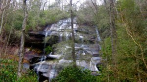 This gem sneaks up on you, especially in the summer. You might completely miss it if you didn’t know where it is. This is an easy hike and a 1 mile round trip – 1/2 mile out and 1/2 mile back. Directions: Follow the directions for Cove Creek Falls instead of parking at the Cove Creek camping parking lot continue on the gravel road for less than a mile. When the road ends park in the area to the right. The trail head is clearly marked as trail #137…it is a fire road. Once you cross the bridge you will pass by the first Daniel Ridge loop trail marker on your left…stay right. Go past second trail marker for Daniel Ridge loop and the waterfall is just a few yards up on the left.
Skinny Dip Falls, Moderate
Technically this fall is just off the Blue Ridge Parkway east of 276. You can probably guess how this falls got its name. In the summer you’ll find many people enjoying a dip in the lovely pools at the base of this little fall. After a walk through dense trees, the path opens to view this little Garden of Eden. The trail is a very easy walk with the exception of one short section that requires you to scramble over roots and rocks. Directions: Take 276 through Pisgah National Forest and turn right off 276 toward the Blue Ridge Parkway then left to get on the Parkway. Park in the Looking Glass Rock Overlook, cross the Parkway to the trail head to the right of the overlook.
Cedar Rock Falls, Moderate
(some tricky roots close to the waterfall)
Each waterfall is unique and each one will give you a little ‘oooooh so beautiful’ moment. Thus is the case with the sweet little waterfall. A little added bonus to this one is that if you go just a little further up the trail you’ll find a fantastic remote camping site. Directions: Directions:Driving from the main intersection to Pisgah National Forest – head North on 276 into the forest and travel for 5.3 miles (along the way you will pass by Davidson River campground on your left, ranger station on your right). At 5.3 miles veer left onto 475 and head toward the Pisgah Center for Wildlife Education. At mile 6.8 you will turn into the parking lot for the Pisgah Center. Once you’ve parked the trailhead is to the left of the building. You’ll see a metal road barrier but you can walk around it. Once you enter the forest take the trail going to the right. (there will be a green fence on your right). Continue straight on the path when you come to the dirt road. The path continues uphill. At 3/4 of a mile you’ll see a small footpath that goes down on the left side – it takes you to the waterfall. Be careful at the bottom – it can be a little tricky.
Courthouse Falls, Moderate
This is one of my favorite waterfalls, it is just beautiful with a small cove at the bottom and is fairly easy to get to once you make it to the trail head. Just make sure you stay on the trail head there are long drop offs on the side of the trail. The little cove that pools at the base of the falls is deep and the water is clear and very cold. Directions: From the Blue Ridge Parkway, head south down Hwy 215 for 6.5 miles. Look for the 2nd sign indicting ‘narrow bridge ahead’, and turn left on 140 just after the bridge. From Hwy 64, turn north on Hwy 215 at Headwaters Outfitters. Drive 10.2 miles up 215 and turn right on FR140 just before the bridge. Drive up the gravel road for 3 miles and park in the wider area just after the bridge across Courthouse Creek.
Dill Falls, Moderate
Dill Falls is on Tanasee Creek in the Nantahala National Forest and is definitely worth the visit. Just inside Jackson County off of Hwy 215. National Forest land on the west side of 215 in Jackson County is Nantahala Forest – the east side of 215 is Pisgah National Forest in Transylvania County. Dill Falls is an easy hike and is now bigger kid friendly. If you are coming from Brevard, take Hwy 64 west out of town and turn right on Hwy 215 at Headwaters Outfitters. Drive 14 miles on 215 north and turn left on Forest Road 4663. From the Blue Ridge Parkway, drive south on 215 for 2 1/2 miles and turn right on RD4663. This forest road is one that is closed during the winter months. There’s a gate 0.6 miles down the road and you could park near the gate and walk the remaining 2 miles to the waterfall. The trail to the main waterfall is straight ahead. Be careful getting close the rocks are very slippery.


